Geography and Maps
Medieval Europeans were fascinated with the exotic, which filled them with a sense of both curiosity and dread. This was compounded by a lack of practical knowledge about the outside world and only a rudimentary knowledge of world geography. Therefore, the so-called Mappa Mundi, such as the famous Hereford Mappa Mundi, was conceptual and presented the worldview of medieval Europeans and their view of themselves within the world.
During the Late Middle Ages, when shipbuilding and seafaring techniques improved, the Age of Exploration began. Europeans came into contact with previously unknown regions of the world and began improving their cartographic techniques in order to create maps that were useful for navigation. Such sea voyages formed the basis for the naval power of the Portuguese, Spaniards, Dutch, and English.
Gorgeous Renaissance atlases based on the recently rediscovered Cosmographia by Claudius Ptolemy and collected volumes of cityscapes like the Civitates Orbis Terrarum became some of the most popular books as educated people wanted to display their sophistication through their knowledge of the world.
Demonstration of a Sample Page
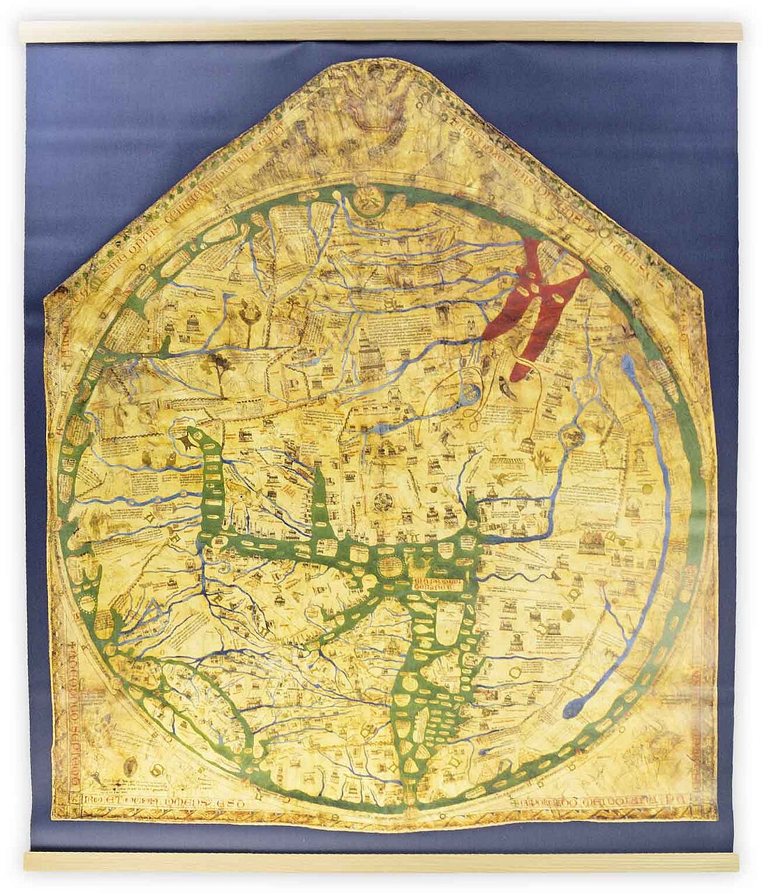
Hereford World Map: Mappa Mundi
The Largest Mappa Mundi
This fully-preserved medieval world map has a diameter of 132 cm, making it larger than any other map of its kind. Like other Mappae Mundi, it is East oriented with the holy city of Jerusalem in the center, but this extensive map identifies another 420 cities as well. Rivers are painted blue while seas and oceans are painted green – except for the Red Sea.
This work is a mixture of geography, world history, biblical history, and mythology – it does not represent the state of geographic knowledge at the dawn of the 14th century but is a conceptual map instead. It is for this reason that the map contains 15 biblical events, 33 animals and plants, 32 people, and five scenes from classical mythology. Curiously, the labels for Africa and Europe are reversed.
")
")
")