Maps of Mexico
(under 1,000€)
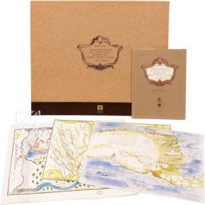
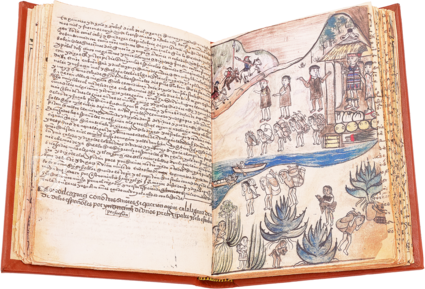
Five maps from the 16th– 18th centuries presenting the various parts of Mexico’s cities, regions, and landscapes. This broadly based compendium of historic maps offers the unique opportunity to immerse oneself in the history of Mexico since its 16th century conquest and settlement by Europeans. Numerous changes, whether regarding newly-founded cities or military armament, formed the geographic image of the land during this epoch. A marvelous variety of historical, geographically exact, and artistically impressive maps of Mexico!
Maps of Mexico
Five maps from the 16th– 18th centuries presenting the various parts of Mexico’s cities, regions, and landscapes. This broadly based compendium of historic maps offers the unique opportunity to immerse oneself in the history of Mexico since its 16th century conquest and settlement by Europeans. Numerous changes, whether regarding newly-founded cities or military armament, formed the geographic image of the land during this epoch. A marvelous variety of historical, geographically exact, and artistically impressive maps of Mexico!
Mexico in Focus
The five maps presented together here are all stored in the Archivo de Indias in Seville. This archive is devoted to the collection of historic documents relating to the Americas since their discovery by Europeans. The Maps of Mexico represent an important aspect thereof.
It is a compendium of five maps that is supposed to present the variety of the collection of the Archivo de Indias. The five maps originate from various times – ranging from the 16th to the 18th centuries – and from various locations. They offer five completely different glimpses of historic Mexico in this way!
Technically Perfect and Artistically Impressive
The Maps of Mexico are sometimes designed with exuberant color, sometimes they are laid out in a gorgeously schematic fashion. Nonetheless, they remain extremely interesting both historically and scientifically, and not only for connoisseurs of cartography. The maps are all of the highest quality both with regard to their artistic execution as well as their informative content. The individual maps present information, inter alia, about the founding of new locales and religious institutions, of military and civilian buildings, and about expeditions exploring still-uncharted regions. Most of the latter was achieved with the permission of the capital and was documented – per the instructions of the Spanish Crown – after their successful completion, wherefore the maps served.
Five Aspects of Mexico’s Geography
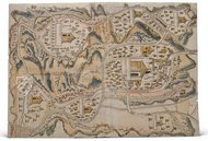
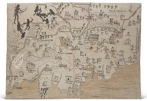
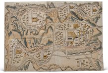
The compendium is comprised of five maps: first, a map of the locality of Tetela de Ocampo from the year 1581. This 44.3 x 70.3 cm map was made for the captain don Crstóbal Godínez y Maldonado. The depiction shows multiple settlements, each with a larger building, which is identifiable as a church thanks to a cross. Decorative people round out the simultaneously informative and representative picture. Next comes a plan of Antequera from the year 1771. This map, measuring 41 x 30.2 cm, shows a view of the city in the Oaxaca valley, and was presumably finished before the occasion of the cathedral’s consecration. Marvelous colors adorn the technically accurate view, whereby the focus of the depiction lays naturally on the church buildings, which are specially marked in the map. A map of New Galicia from the year 1550 enriches the compendium with a real treasure. It is one of the oldest maps of Guadalajara. A map of Guanajuato from the 18th century presents itself as a typically schematic depiction of that time. Finally, the Maps of Mexico contains one more treasure of Mexican history: the panoramic view of the city of Salto de Agua Chiapas from the year 1795!
Codicology
- Alternative Titles
- Maps of Mexico in the General Archives of the Indies
Karten von Mexiko - Type
- Map on paper
- Date
- 16th–18th century
- Epochs
- Style
- Genre
- Language
Maps of Mexico
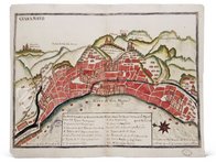
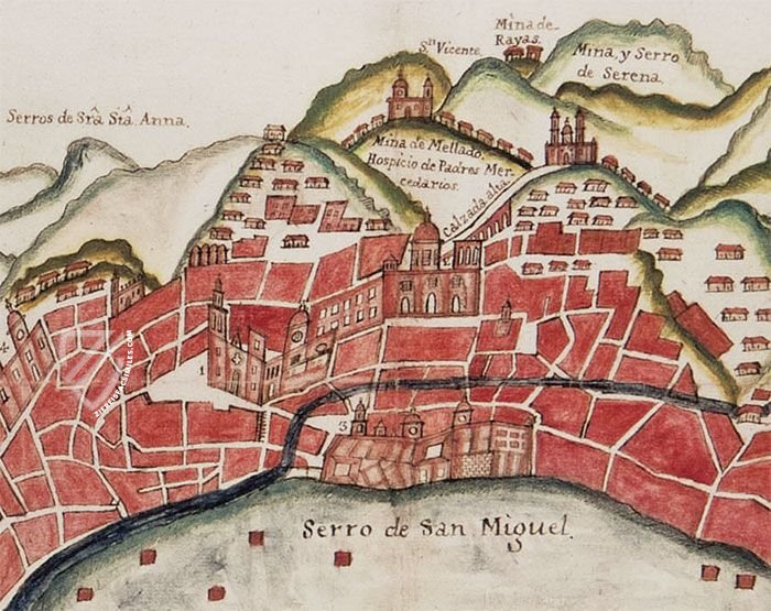
Schematic Map of Guanajuato
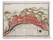
The capital city of the central Mexican state of the same name grew into a beautiful and important city thanks to the mineral wealth extracted from the mountains surrounding it. At one point, two-thirds of the world’s silver was produced in the La Valenciana mine near the city, making it the richest city in Mexico. As a result, the gorgeous Baroque architecture of its historic city center is a UNESCO World Heritage Site today. This schematic depiction of the city is typical of the 18th century.
Maps of Mexico
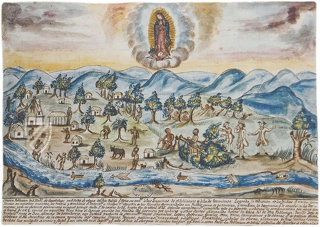
Panoramic View of the Villa de Salto de Aqua
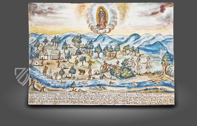
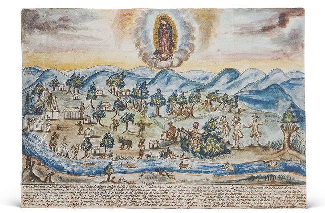
Located in the modern Mexican state of Chiapas, this lovely cityscape originates from the year 1795. It is a pen and ink drawing that was lovingly embellished with watercolors to create this idealized, pastoral depiction of the settlement that was then known as San Fernando de Guadalupe. Fittingly, the Virgin of Guadalupe, Mexico’s most important religious symbol, reigns over the scene.
This is a depiction of the labors undertaken in founding the settlement, and as such depicts indigenous fishermen and lumberjacks working at the direction of the Spanish mayor and other officials, identifiable by their tricornes, frock coats, and short breeches. An arrow indicates the flow of the Tulijá River, which also features boats and a dock.
#1 Mapas de México en el Archivo de Indias
Language: Spanish
(under 1,000€)
- Treatises / Secular Books
- Apocalypses / Beatus
- Astronomy / Astrology
- Bestiaries
- Bibles / Gospels
- Chronicles / History / Law
- Geography / Maps
- Saints' Lives
- Islam / Oriental
- Judaism / Hebrew
- Single Leaf Collections
- Leonardo da Vinci
- Literature / Poetry
- Liturgical Manuscripts
- Medicine / Botany / Alchemy
- Music
- Mythology / Prophecies
- Psalters
- Other Religious Books
- Games / Hunting
- Private Devotion Books
- Other Genres
- Afghanistan
- Armenia
- Austria
- Belgium
- Belize
- Bosnia and Herzegovina
- China
- Colombia
- Costa Rica
- Croatia
- Cyprus
- Czech Republic
- Denmark
- Egypt
- El Salvador
- Ethiopia
- France
- Germany
- Greece
- Guatemala
- Honduras
- Hungary
- India
- Iran
- Iraq
- Israel
- Italy
- Japan
- Jordan
- Kazakhstan
- Kyrgyzstan
- Lebanon
- Liechtenstein
- Luxembourg
- Mexico
- Morocco
- Netherlands
- Palestine
- Panama
- Peru
- Poland
- Portugal
- Romania
- Russia
- Serbia
- Spain
- Sri Lanka
- Sweden
- Switzerland
- Syria
- Tajikistan
- Turkey
- Turkmenistan
- Ukraine
- United Kingdom
- United States
- Uzbekistan
- Vatican City
- A. Oosthoek, van Holkema & Warendorf
- Aboca Museum
- Ajuntament de Valencia
- Akademie Verlag
- Akademische Druck- u. Verlagsanstalt (ADEVA)
- Aldo Ausilio Editore - Bottega d’Erasmo
- Alecto Historical Editions
- Alkuin Verlag
- Almqvist & Wiksell
- Amilcare Pizzi
- Andreas & Andreas Verlagsbuchhandlung
- Archa 90
- Archiv Verlag
- Archivi Edizioni
- Arnold Verlag
- ARS
- Ars Magna
- Art Market
- ArtCodex
- AyN Ediciones
- Azimuth Editions
- Badenia Verlag
- Bärenreiter-Verlag
- Belser Verlag
- Belser Verlag / WK Wertkontor
- Benziger Verlag
- Bernardinum Wydawnictwo
- BiblioGemma
- Biblioteca Apostolica Vaticana (Vaticanstadt, Vaticanstadt)
- Bibliotheca Palatina Faksimile Verlag
- Bibliotheca Rara
- Boydell & Brewer
- Bramante Edizioni
- Bredius Genootschap
- Brepols Publishers
- British Library
- C. Weckesser
- Caixa Catalunya
- Canesi
- CAPSA, Ars Scriptoria
- Caratzas Brothers, Publishers
- Carus Verlag
- Casamassima Libri
- Centrum Cartographie Verlag GmbH
- Chavane Verlag
- Christian Brandstätter Verlag
- Circulo Cientifico
- Club Bibliófilo Versol
- Club du Livre
- CM Editores
- Collegium Graphicum
- Collezione Apocrifa Da Vinci
- Comissão Nacional para as Comemorações dos Descobrimentos Portugueses
- Coron Verlag
- Corvina
- CTHS
- D. S. Brewer
- Damon
- De Agostini/UTET
- De Nederlandsche Boekhandel
- De Schutter
- Deuschle & Stemmle
- Deutscher Verlag für Kunstwissenschaft
- DIAMM
- Dropmore Press
- Droz
- E. Schreiber Graphische Kunstanstalten
- Ediciones Boreal
- Ediciones Grial
- Ediclube
- Edições Inapa
- Edilan
- Editalia
- Edition Deuschle
- Edition Georg Popp
- Edition Leipzig
- Edition Libri Illustri
- Editiones Reales Sitios S. L.
- Éditions de l'Oiseau Lyre
- Editions Medicina Rara
- Editorial Casariego
- Editorial Mintzoa
- Editrice Antenore
- Editrice Velar
- Edizioni Edison
- Egeria, S.L.
- Eikon Editores
- Electa
- Emery Walker Limited
- Enciclopèdia Catalana
- Eos-Verlag
- Ephesus Publishing
- Ernst Battenberg
- Eugrammia Press
- Extraordinary Editions
- Fackelverlag
- Facsimila Art & Edition
- Facsimile Editions Ltd.
- Facsimilia Art & Edition Ebert KG
- Faksimile Verlag
- Feuermann Verlag
- Folger Shakespeare Library
- Franco Cosimo Panini Editore
- Friedrich Wittig Verlag
- Fundación Hullera Vasco-Leonesa
- G. Braziller
- Gabriele Mazzotta Editore
- Gebr. Mann Verlag
- Gesellschaft für graphische Industrie
- Getty Research Institute
- Giovanni Domenico de Rossi
- Giunti Editore
- Graffiti
- Grafica European Center of Fine Arts
- Guido Pressler
- Guillermo Blazquez
- Gustav Kiepenheuer
- H. N. Abrams
- Harrassowitz
- Harvard University Press
- Helikon
- Hendrickson Publishers
- Henning Oppermann
- Herder Verlag
- Hes & De Graaf Publishers
- Hoepli
- Holbein-Verlag
- Houghton Library
- Hugo Schmidt Verlag
- Idion Verlag
- Il Bulino, edizioni d'arte
- ILte
- Imago
- Insel Verlag
- Insel-Verlag Anton Kippenberger
- Instituto de Estudios Altoaragoneses
- Instituto Nacional de Antropología e Historia
- Introligatornia Budnik Jerzy
- Istituto dell'Enciclopedia Italiana - Treccani
- Istituto Ellenico di Studi Bizantini e Postbizantini
- Istituto Geografico De Agostini
- Istituto Poligrafico e Zecca dello Stato
- Italarte Art Establishments
- Jan Thorbecke Verlag
- Johnson Reprint Corporation
- Johnson Reprint Corporation
- Josef Stocker
- Josef Stocker-Schmid
- Jugoslavija
- Karl W. Hiersemann
- Kasper Straube
- Kaydeda Ediciones
- Kindler Verlag / Coron Verlag
- Kodansha International Ltd.
- Konrad Kölbl Verlag
- Kurt Wolff Verlag
- La Liberia dello Stato
- La Linea Editrice
- La Meta Editore
- Lambert Schneider
- Landeskreditbank Baden-Württemberg
- Leo S. Olschki
- Les Incunables
- Liber Artis
- Library of Congress
- Libreria Musicale Italiana
- Lichtdruck
- Lito Immagine Editore
- Lumen Artis
- Lund Humphries
- M. Moleiro Editor
- Maison des Sciences de l'homme et de la société de Poitiers
- Manuscriptum
- Martinus Nijhoff
- Maruzen-Yushodo Co. Ltd.
- MASA
- Massada Publishers
- McGraw-Hill
- Metropolitan Museum of Art
- Militos
- Millennium Liber
- Müller & Schindler
- Nahar - Stavit
- Nahar and Steimatzky
- National Library of Wales
- Neri Pozza
- Nova Charta
- Oceanum Verlag
- Odeon
- Omnia Arte
- Orbis Mediaevalis
- Orbis Pictus
- Österreichische Staatsdruckerei
- Oxford University Press
- Pageant Books
- Parzellers Buchverlag
- Patrimonio Ediciones
- Pattloch Verlag
- PIAF
- Pieper Verlag
- Plon-Nourrit et cie
- Poligrafiche Bolis
- Presses Universitaires de Strasbourg
- Prestel Verlag
- Princeton University Press
- Prisma Verlag
- Priuli & Verlucca, editori
- Pro Sport Verlag
- Propyläen Verlag
- Pytheas Books
- Quaternio Verlag Luzern
- Reales Sitios
- Recht-Verlag
- Reichert Verlag
- Reichsdruckerei
- Reprint Verlag
- Riehn & Reusch
- Roberto Vattori Editore
- Rosenkilde and Bagger
- Roxburghe Club
- Salerno Editrice
- Saltellus Press
- Sandoz
- Sarajevo Svjetlost
- Schöck ArtPrint Kft.
- Schulsinger Brothers
- Scolar Press
- Scrinium
- Scripta Maneant
- Scriptorium
- Shazar
- Siloé, arte y bibliofilia
- SISMEL - Edizioni del Galluzzo
- Sociedad Mexicana de Antropología
- Société des Bibliophiles & Iconophiles de Belgique
- Soncin Publishing
- Sorli Ediciones
- Stainer and Bell
- Studer
- Styria Verlag
- Sumptibus Pragopress
- Szegedi Tudomànyegyetem
- Taberna Libraria
- Tarshish Books
- Taschen
- Tempus Libri
- Testimonio Compañía Editorial
- TGB Limited Editions
- Thames and Hudson
- The Clear Vue Publishing Partnership Limited
- The Facsimile Codex
- The Folio Society
- The Marquess of Normanby
- The Richard III and Yorkist History Trust
- Tip.Le.Co
- TouchArt
- TREC Publishing House
- TRI Publishing Co.
- Trident Editore
- Tuliba Collection
- Typis Regiae Officinae Polygraphicae
- Union Verlag Berlin
- Universidad de Granada
- Universitaire Bibliotheken Leiden
- University of California Press
- University of Chicago Press
- Urs Graf
- Vallecchi
- Van Wijnen
- VCH, Acta Humaniora
- VDI Verlag
- VEB Deutscher Verlag für Musik
- Verlag Anton Pustet / Andreas Verlag
- Verlag Bibliophile Drucke Josef Stocker
- Verlag der Münchner Drucke
- Verlag für Regionalgeschichte
- Verlag Styria
- Vicent Garcia Editores
- W. Turnowski Ltd.
- W. Turnowsky
- Waanders Printers
- Wiener Mechitharisten-Congregation (Wien, Österreich)
- Wissenschaftliche Buchgesellschaft
- Wissenschaftliche Verlagsgesellschaft
- Wydawnictwo Dolnoslaskie
- Xuntanza Editorial
- Zakład Narodowy
- Zollikofer AG

