Heinrich Bunting's Maps

Germany — Late 16th century
Mountains and cities, but also mythical creatures and ancient heroes: a fascinating cartographic balancing act between new knowledge and a biblical-mythological worldview
Heinrich Bünting (1545–1606) portrayed Europe in the form of the Virgin as Queen while Asia had the form of the Pegasus
Mountains, cities, bodies of water, animals, fantastical creatures, and splendid sailing ships fill the work
Bünting manages the balancing act between new knowledge and a biblically characterized worldview
Heinrich Bunting's Maps


(under 1,000€)
With his famous Itinerarium Sacrae Scripturae, the Hanoverian theologian and chronicler Heinrich Bünting composed a true bestseller at the end of the 16th century. The maps and descriptions, in which biblical stories are geographically located, were widely disseminated and translated into numerous languages. With his maps, Bünting managed to link the cartography of his time with emblematic illustrations and, for example, depicted Europa in the form of the Virgin with the insignias of the Queen or Asia as a Pegasus. Wonderfully colored in parts, the compendium of 17 sheets offers the opportunity to immerse oneself in the biblical stories and their corresponding geographical location, and in doing so to directly experience the piety of the 16th century and at the same time the drive for new insights during this time.
Heinrich Bunting's Maps
With his famous Itinerarium Sacrae Scripturae, the Hanoverian theologian and chronicler Heinrich Bünting composed a true bestseller at the end of the 16th century. The maps and descriptions, in which biblical stories are geographically located, were widely disseminated and translated into numerous languages. With his maps, Bünting managed to link the cartography of his time with emblematic illustrations and, for example, depicted Europa in the form of the Virgin with the insignias of the Queen or Asia as a Pegasus. Wonderfully colored in parts, the compendium of 17 sheets offers the opportunity to immerse oneself in the biblical stories and their corresponding geographical location, and in doing so to directly experience the piety of the 16th century and at the same time the drive for new insights during this time.
The Old World and the New
The “Old World” of the 16th centuries consisted of three continents, Europe, Asia, and Africa. America, the “New World,” was already discovered and was even cartographically depicted. With Heinrich Bünting, however, the worldview of the Bible was center stage. A page of his Itinerarium Sacrae Scripturae clearly shows this view: which groups the three established continents around Jerusalem in the middle like three sheets of a cloverleaf – an allusion to the heraldic device of Bunting’s home city of Hannover. Below and to the left is a truncated depiction of “America and the New World”. Bunting’s work, this “complete collection of the knowledge at that time concerning biblical geography” manages the balancing act between new knowledge and the biblically characterized worldview, and is thereby a wonderful expression of the 16th century Zeitgeist: the piety that simultaneously ruled the great discoveries and upheavals of this time.
Europe as a Queen and the Square City
Heinrich Bünting’s map series is titled as a travel book for the entirety of the Holy Scriptures. It contains maps of the three continents, of the Mediterranean and its surrounding regions, of individual countries such as Egypt or Judea and Samaria, or of Jerusalem the Holy “Squared” City. Bünting portrayed Europe in the form of the Virgin as Queen with the insignia of power: the Imperial Crown, Scepter, and Orb; Asia, the “second continent,” had the form of the Pegasus, the winged horse from Greek mythology. Alongside these emblematic depictions, the cartographer also shows maps with realistic images of the continents and individual regions, such as the description of the Holy Land and a neighboring text with the description of where Zacharias, the father of John the Baptist, had lived. Each map is accompanied by a clarifying text – sometimes on the back – that connects the biblical story with the geography.
An Entertaining Treat for the Eyes
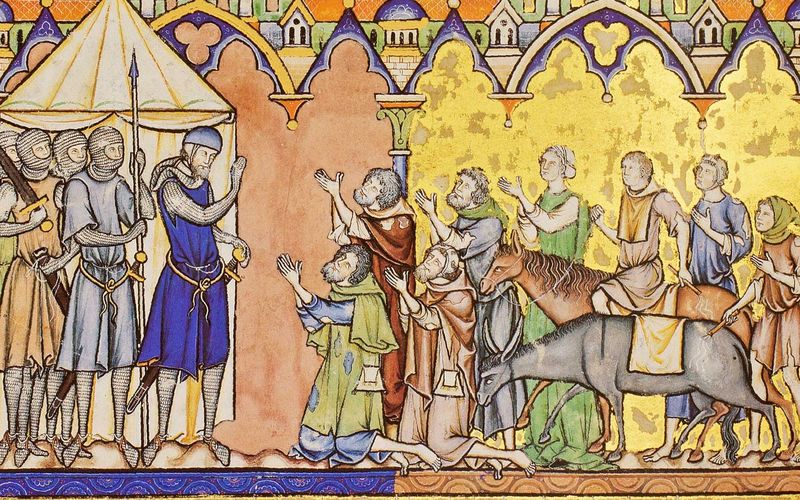
With his compendium, Heinrich Bünting (1545–1606), who was simultaneously a theologian, geographer, and chronicler presented a work of art and information, which met the Zeitgeist of the late 16th century. The theologian, who was active in the Duchy of Brunswick-Lüneburg, created a printed work that still offers the opportunity to immerse oneself in this exciting theme and simultaneously enjoy the great artistry with which it was made. The maps contain, alongside detailed designations for coasts, mountains, cities, bodies of water and seas, wonderfully entertaining illustrations. Thus there are countless marine animals, fantastical creatures, and splendid sailing ships.
Codicology
- Alternative Titles
- Mapas de Heinrich Bunting
Itinerarium Sacrae Scripturae
Maps of Heinrich Bunting
Karten von Heinrich Bunting
Maps for the Itinerary of Sacred Scripture
Itinerarium Sacrae Scripturae
Ein Reisebuch über die ganze Heilige Schrifft
Heinrich Bünting's Maps - Type
- Map on paper
- Origin
- Germany
- Date
- Late 16th century
- Epochs
- Style
- Genre
- Language
- Illustrations
- 17 maps
- Artist / School
- Heinrich Bünting (1545–1606)

Heinrich Bunting's Maps
The Eastern Mediterranean
The important cities of the Middle East from the Holy Land to the eastern borders of Persia are shown here as part of the chest and torso of a winged Pegasus, which opens its mouth to take a bite of Europe as though it were an apple. Despite its mythical and symbolic nature, the map is remarkably accurate and includes the islands of Crete, Rhodes, and Cyprus, shows the Nile Delta in Egypt, and distinguishes the regions of Russia and Muscovy from one another in Europe.

Heinrich Bunting's Maps
EVROPA PRIMA PARS TERRÆ IN FORMA VIRGINIS
The visual personification of the European continent as a young woman known as Europa Regina originated in the early–16th century, when Holy Roman Emperor Charles V came closer to uniting Europe than anyone since Charlemagne. Titled here "Europe in the shape of a maiden", it is a west-oriented map with Spain as the crowned head, indicating its preeminent status.
France and Germany make up the body, with Bohemia depicted as the heart because it was a Humanist haven of religious tolerance at the time. Italy’s ongoing importance is represented by the right arm, with Sicily’s key position in European politics highlighted by the orb. The left arm with the scepter reflects the rising status of Scandinavia and the British Isles.

#1 Mapas de Heinrich Bünting
Language: Spanish
(under 1,000€)
")
")
")
")
")
- Treatises / Secular Books
- Apocalypses / Beatus
- Astronomy / Astrology
- Bestiaries
- Bibles / Gospels
- Chronicles / History / Law
- Geography / Maps
- Saints' Lives
- Islam / Oriental
- Judaism / Hebrew
- Single Leaf Collections
- Leonardo da Vinci
- Literature / Poetry
- Liturgical Manuscripts
- Medicine / Botany / Alchemy
- Music
- Mythology / Prophecies
- Psalters
- Other Religious Books
- Games / Hunting
- Private Devotion Books
- Other Genres
- Afghanistan
- Armenia
- Austria
- Belgium
- Belize
- Bosnia and Herzegovina
- China
- Colombia
- Costa Rica
- Croatia
- Cyprus
- Czech Republic
- Denmark
- Egypt
- El Salvador
- Ethiopia
- France
- Germany
- Greece
- Guatemala
- Honduras
- Hungary
- India
- Iran
- Iraq
- Israel
- Italy
- Japan
- Jordan
- Kazakhstan
- Kyrgyzstan
- Lebanon
- Liechtenstein
- Luxembourg
- Mexico
- Morocco
- Netherlands
- Palestine
- Panama
- Peru
- Poland
- Portugal
- Romania
- Russia
- Serbia
- Spain
- Sri Lanka
- Sweden
- Switzerland
- Syria
- Tajikistan
- Turkey
- Turkmenistan
- Ukraine
- United Kingdom
- United States
- Uzbekistan
- Vatican City
- A. Oosthoek, van Holkema & Warendorf
- Aboca Museum
- Ajuntament de Valencia
- Akademie Verlag
- Akademische Druck- u. Verlagsanstalt (ADEVA)
- Aldo Ausilio Editore - Bottega d’Erasmo
- Alecto Historical Editions
- Alkuin Verlag
- Almqvist & Wiksell
- Amilcare Pizzi
- Andreas & Andreas Verlagsbuchhandlung
- Archa 90
- Archiv Verlag
- Archivi Edizioni
- Arnold Verlag
- ARS
- Ars Magna
- Ars Millenii
- Art Market
- ArtCodex
- AyN Ediciones
- Azimuth Editions
- Badenia Verlag
- Bärenreiter-Verlag
- Belser Verlag
- Belser Verlag / WK Wertkontor
- Benziger Verlag
- Bernardinum Wydawnictwo
- BiblioGemma
- Biblioteca Apostolica Vaticana (Vaticanstadt, Vaticanstadt)
- Bibliotheca Palatina Faksimile Verlag
- Bibliotheca Rara
- Boydell & Brewer
- Bramante Edizioni
- Bredius Genootschap
- Brepols Publishers
- British Library
- Brokarte
- C. Weckesser
- Caixa Catalunya
- Canesi
- CAPSA, Ars Scriptoria
- Caratzas Brothers, Publishers
- Carus Verlag
- Casamassima Libri
- Centrum Cartographie Verlag GmbH
- Chavane Verlag
- Christian Brandstätter Verlag
- Circulo Cientifico
- Club Bibliófilo Versol
- Club du Livre
- Club Internacional del Libro
- CM Editores
- Collegium Graphicum
- Collezione Apocrifa Da Vinci
- Comissão Nacional para as Comemorações dos Descobrimentos Portugueses
- Coron Verlag
- Corvina
- CTHS
- D. S. Brewer
- Damon
- De Agostini/UTET
- De Nederlandsche Boekhandel
- De Schutter
- Deuschle & Stemmle
- Deutscher Verlag für Kunstwissenschaft
- DIAMM
- Dropmore Press
- Droz
- E. Schreiber Graphische Kunstanstalten
- Ediciones Boreal
- Ediciones Grial
- Ediclube
- Edições Inapa
- Edilan
- Editalia
- Edition Deuschle
- Edition Georg Popp
- Edition Leipzig
- Edition Libri Illustri
- Editiones Reales Sitios S. L.
- Éditions de l'Oiseau Lyre
- Editions Medicina Rara
- Editorial Casariego
- Editorial Mintzoa
- Editrice Antenore
- Editrice Velar
- Edizioni Edison
- Egeria, S.L.
- Eikon Editores
- Electa
- Emery Walker Limited
- Enciclopèdia Catalana
- Eos-Verlag
- Ephesus Publishing
- Ernst Battenberg
- Eugrammia Press
- Extraordinary Editions
- Fackelverlag
- Facsimila Art & Edition
- Facsimile Editions Ltd.
- Facsimilia Art & Edition Ebert KG
- Faksimile Verlag
- Feuermann Verlag
- Folger Shakespeare Library
- Franco Cosimo Panini Editore
- Friedrich Wittig Verlag
- Fundación Hullera Vasco-Leonesa
- G. Braziller
- Gabriele Mazzotta Editore
- Gebr. Mann Verlag
- Gesellschaft für graphische Industrie
- Getty Research Institute
- Giovanni Domenico de Rossi
- Giunti Editore
- Goldenmark Librarium
- Graffiti
- Grafica European Center of Fine Arts
- Guido Pressler
- Guillermo Blazquez
- Gustav Kiepenheuer
- H. N. Abrams
- Harrassowitz
- Harvard University Press
- Helikon
- Hendrickson Publishers
- Henning Oppermann
- Herder Verlag
- Hes & De Graaf Publishers
- Hoepli
- Holbein-Verlag
- Houghton Library
- Hugo Schmidt Verlag
- Hungarian Academy of Sciences
- Idion Verlag
- Il Bulino, edizioni d'arte
- ILte
- Imago
- Insel Verlag
- Insel-Verlag Anton Kippenberger
- Instituto de Estudios Altoaragoneses
- Instituto Nacional de Antropología e Historia
- Introligatornia Budnik Jerzy
- Istituto dell'Enciclopedia Italiana - Treccani
- Istituto Ellenico di Studi Bizantini e Postbizantini
- Istituto Geografico De Agostini
- Istituto Poligrafico e Zecca dello Stato
- Italarte Art Establishments
- Jaca Book
- Jan Thorbecke Verlag
- Johnson Reprint Corporation
- Johnson Reprint Corporation
- Jos. Baer
- Josef Stocker
- Josef Stocker-Schmid
- Jugoslavija
- Karl W. Hiersemann
- Kasper Straube
- Kaydeda Ediciones
- Kindler Verlag / Coron Verlag
- Kodansha International Ltd.
- Konrad Kölbl Verlag
- Kurt Wolff Verlag
- La Liberia dello Stato
- La Linea Editrice
- La Meta Editore
- Lambert Schneider
- Landeskreditbank Baden-Württemberg
- Leo S. Olschki
- Les Incunables
- Liber Artis
- Library of Congress
- Libreria Musicale Italiana
- Lichtdruck
- Lito Immagine Editore
- Lumen Artis
- Lund Humphries
- M. Moleiro Editor
- Maison des Sciences de l'homme et de la société de Poitiers
- Manuscriptum
- Martinus Nijhoff
- Maruzen-Yushodo Co. Ltd.
- MASA
- Massada Publishers
- McGraw-Hill
- Metropolitan Museum of Art
- Militos
- Millennium Liber
- Müller & Schindler
- Nahar - Stavit
- Nahar and Steimatzky
- National Library of Wales
- Neri Pozza
- Nova Charta
- Oceanum Verlag
- Odeon
- Omnia Arte
- Orbis Mediaevalis
- Orbis Pictus
- Österreichische Staatsdruckerei
- Oxford University Press
- Pageant Books
- Parzellers Buchverlag
- Patrimonio Ediciones
- Pattloch Verlag
- PIAF
- Pieper Verlag
- Plon-Nourrit et cie
- Poligrafiche Bolis
- Presses Universitaires de Strasbourg
- Prestel Verlag
- Princeton University Press
- Prisma Verlag
- Priuli & Verlucca, editori
- Pro Sport Verlag
- Propyläen Verlag
- Pytheas Books
- Quaternio Verlag Luzern
- Reales Sitios
- Recht-Verlag
- Reichert Verlag
- Reichsdruckerei
- Reprint Verlag
- Riehn & Reusch
- Roberto Vattori Editore
- Rosenkilde and Bagger
- Roxburghe Club
- Salerno Editrice
- Saltellus Press
- Sandoz
- Sarajevo Svjetlost
- Schöck ArtPrint Kft.
- Schulsinger Brothers
- Scolar Press
- Scrinium
- Scripta Maneant
- Scriptorium
- Shazar
- Siloé, arte y bibliofilia
- SISMEL - Edizioni del Galluzzo
- Sociedad Mexicana de Antropología
- Société des Bibliophiles & Iconophiles de Belgique
- Soncin Publishing
- Sorli Ediciones
- Stainer and Bell
- Studer
- Styria Verlag
- Sumptibus Pragopress
- Szegedi Tudomànyegyetem
- Taberna Libraria
- Tarshish Books
- Taschen
- Tempus Libri
- Testimonio Compañía Editorial
- TGB Limited Editions
- Thames and Hudson
- The Clear Vue Publishing Partnership Limited
- The Facsimile Codex
- The Folio Society
- The Marquess of Normanby
- The Orphan Hospital Ward of Israel
- The Richard III and Yorkist History Trust
- The Warburg Institute
- Tip.Le.Co
- TouchArt
- TREC Publishing House
- TRI Publishing Co.
- Trident Editore
- Tuliba Collection
- Typis Regiae Officinae Polygraphicae
- Union Verlag Berlin
- Universidad de Granada
- Universitaire Bibliotheken Leiden
- University of California Press
- University of Chicago Press
- Urs Graf
- Vallecchi
- Van Wijnen
- VCH, Acta Humaniora
- VDI Verlag
- VEB Deutscher Verlag für Musik
- Verein Schweizerischer Lithographie-Besitzer
- Verlag Anton Pustet / Andreas Verlag
- Verlag Bibliophile Drucke Josef Stocker
- Verlag der Münchner Drucke
- Verlag für Regionalgeschichte
- Verlag Styria
- Vicent Garcia Editores
- W. Turnowsky
- Waanders Printers
- Wiener Mechitharisten-Congregation (Wien, Österreich)
- Wissenschaftliche Buchgesellschaft
- Wissenschaftliche Verlagsgesellschaft
- Wydawnictwo Dolnoslaskie
- Xuntanza Editorial
- Zakład Narodowy
- Zollikofer AG